


Manpo app for iPhone and iPad
Developer: 東京大学空間情報科学研究センター
First release : 02 Nov 2017
App size: 34.14 Mb
Manpo (漫歩/漫步) is a Japanese / Chinese word that means ramble or stroll (having a walk around). This app Manpo is mainly designed for walking tours with maps of various kinds. With Manpo, you can import analog maps, such as hand-drawn maps, illustrated maps, old maps, and so on, to your iPhone or iPad, enhance them with multimedia content for self-guided tours, storytelling or personal memorial. With Manpo, the analog maps can be geo-enabled for GPS positioning. You can view your current location and moving trajectories on the geo-enabled analog maps and access the nearby content on the maps.
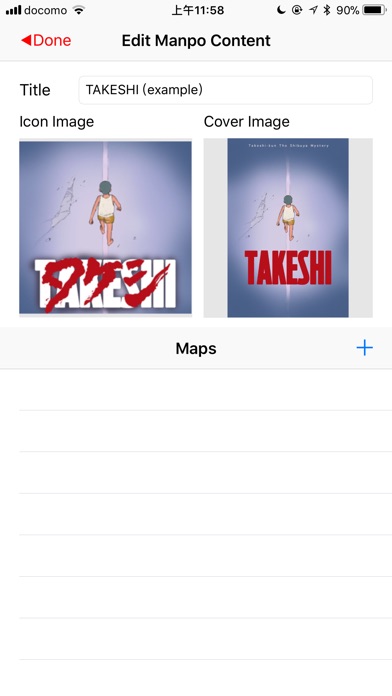
Edit Functions of Manpo:
1. Import map images from iPhone/iPads photos or computers through iTunes.
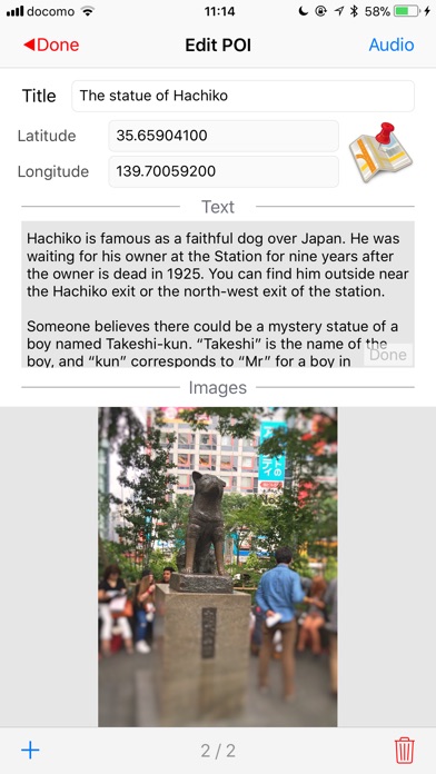
2. Create POI (point of interest) on the map image with photos, audio, text, and correspond it to a geographic location
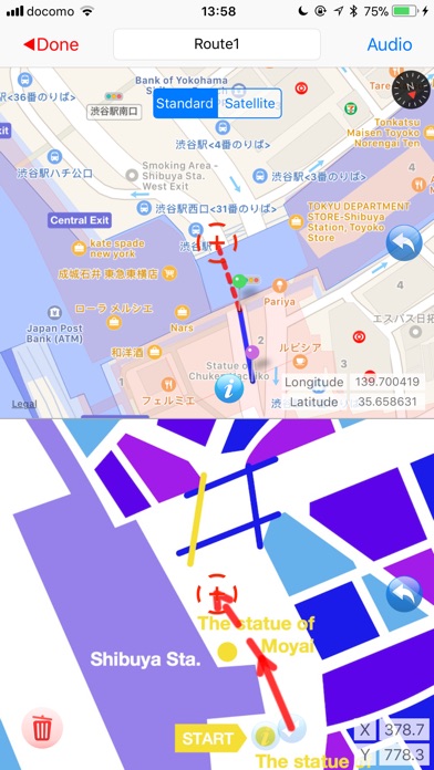
3. Create lines of routes on the map image with audio guides
4. Create control points on the map image for improving the accuracy of the positioning on analog maps
Browse Functions of Manpo:
1. View the imported analog maps and multimedia content with touchscreen functions
2. Show current location and moving trajectory on the analog maps
3. Invoke the nearby POI using location information
4. Take your own photos of a POI
5. Appreciate audio guide along the walking route
6. Playback the trajectory after your tour
Manual:
http://ubimap.csis.u-tokyo.ac.jp/manpoproject/index.php/manpo-top/how-to-use-manpo
The example data come from the app TAKESHI:
https://itunes.apple.com/app/takeshi/id1060351739